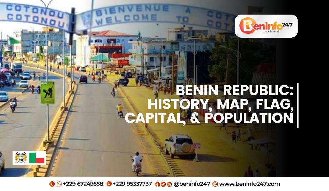
Benin Republic: History, Map, Flag, Capital, And Population
Benin Republic, officially known as the Republic of Benin, is a West African country located between Nigeria to the east and Togo to the west. The country’s name is derived from the ancient kingdom of Benin, which was located in what is now Nigeria but covered a vast area that extended into the modern-day Benin Republic.
The Kingdom of Benin, also known as the Edo Empire, was one of the oldest and most powerful states in West Africa, with a complex and sophisticated culture that spanned over 700 years. The kingdom was known for its impressive bronze and ivory sculptures, which can be found in museums around the world. The name “Benin” is thought to have originated from the Bini people, who were one of the main ethnic groups in the kingdom.
In the late 19th century, European powers began colonizing much of Africa, and the Kingdom of Benin was no exception. In 1897, a British expeditionary force attacked the capital city of Benin City, looting many of its treasures and burning the palace to the ground. The kingdom was then annexed by the British Empire and became part of Nigeria.
After gaining independence from Britain in 1960, Nigeria remained a federal republic until 1963, when it was briefly renamed the Federal Republic of Nigeria-Biafra. In 1967, the eastern region of Nigeria declared independence and formed the breakaway state of Biafra, leading to a bloody civil war that lasted until 1970. After the war, Nigeria was re-established as a federal republic and remains one to this day.
Meanwhile, the area that is now Benin Republic was known as Dahomey and was a French colony from 1894 until it gained independence in 1960. The country was renamed the Republic of Dahomey, and in 1975 it was renamed again to the People’s Republic of Benin after the ancient kingdom of Benin.
Today, Benin Republic is a democratic country with a population of over 12 million people. It is known for its vibrant culture, rich history, and beautiful natural landscapes. The country has a diverse economy, with agriculture, mining, and manufacturing among its key industries. It is also home to many UNESCO World Heritage Sites, including the Royal Palaces of Abomey and the Pendjari National Park.
In conclusion, Benin Republic’s name is derived from the ancient Kingdom of Benin, which was located in what is now Nigeria but extended into the modern-day Benin Republic. The country has a complex and fascinating history, from the kingdom’s sophisticated culture to European colonization and subsequent independence movements. Today, Benin Republic is a vibrant and diverse country that offers a unique travel experience for those seeking to explore West Africa’s rich culture and history.
The Benin Republic Map
The map of Benin Republic is an important tool that helps people understand the geography of this West African nation. It is a visual representation of the country’s physical features, borders, and major cities, as well as its location within the region.
The first maps of the region that is now Benin Republic were created by European explorers and traders in the 16th and 17th centuries. These maps were crude and often inaccurate, as the explorers had limited knowledge of the area’s topography and were often more interested in mapping out trade routes than in creating accurate representations of the land.
In the late 19th century, as European powers began colonizing much of Africa, more detailed maps of the region began to emerge. The French, who colonized what is now Benin Republic, were particularly interested in creating accurate maps of the area, as they needed to know the geography of the region to effectively administer it.
One of the most important figures in the history of mapping Benin Republic was Alexandre Liotard, a French cartographer who spent much of his career mapping out the West African coast. In the late 1800s, Liotard was tasked with mapping the colony of Dahomey (which later became Benin Republic) and created one of the earliest detailed maps of the region.
The modern map of Benin Republic that we use today was likely created in the years immediately following the country’s independence from France in 1960. The map shows the country’s borders, major cities, and physical features, such as rivers and mountains. It is an important tool for travelers, researchers, and policymakers who need to understand the country’s geography.
The day when the modern map of Benin Republic was officially announced is not well-documented, as maps are typically published and distributed gradually over time. However, likely, the map was first introduced in the years following the country’s independence, as the new government worked to establish its own identity and territorial integrity.
In terms of what the map means, it is a visual representation of Benin Republic’s national identity and territorial boundaries. It shows where the country begins and ends, and provides a framework for understanding its physical features and major population centers. For the people of Benin Republic, the map is a symbol of their nationhood and a source of pride in their country’s history and geography.
In conclusion, the map of Benin Republic is an important tool for understanding the geography of this West African nation. It has a long and complex history, from the crude maps of European explorers to the detailed maps of French colonial cartographers to the modern map that we use today. Whether you are a traveler, researcher, or policymaker, the map of Benin Republic is an essential tool for understanding the country’s physical features, borders, and major cities.
The Benin Republic Flag
The flag of Benin Republic is a national symbol that represents the country’s cultural heritage and its commitment to democracy and unity. The flag features two horizontal stripes – a green stripe at the top and a red stripe at the bottom – with a yellow star in the center. The flag was designed by the country’s first president, Mathieu Kerekou, and was adopted on November 16, 1959, shortly before the country gained independence from France on August 1, 1960.
The green stripe on the flag represents the country’s lush vegetation and agricultural wealth. Benin Republic is known for its fertile land and is a major exporter of cotton, palm oil, and other agricultural products. The red stripe represents the country’s history of struggle for independence and sovereignty. The yellow star in the center of the flag represents the bright future of the country and its commitment to unity and progress.
The flag’s design has evolved over the years, with changes made to reflect the country’s changing political landscape. In 1975, the flag was modified to include the country’s coat of arms in the center, which featured a shield with an elephant and palm tree, as well as the motto “Fraternité, Justice, Travail” (Brotherhood, Justice, Work). This version of the flag was used until 1990 when a new democratic government was established, and the coat of arms was removed to reflect the country’s new era of democracy and unity.
The flag is an important symbol of national identity and pride for the people of Benin Republic. It is often displayed at public events, such as sports matches and political rallies, as well as at schools and government buildings throughout the country. The flag is also a powerful reminder of the country’s history and its journey toward independence and democracy.
The Benin Republic Capital and Population
The capital city of Benin Republic is Porto-Novo, which is also the country’s second-largest city after Cotonou. The city was established as a Portuguese trading post in the late 16th century and later became a French colonial center in the 19th century.
Porto-Novo’s first investments were made in the late 19th and early 20th centuries, during the French colonial period. The city’s infrastructure was developed to support the trade of agricultural products, such as palm oil, rubber, and cotton, which were grown in the surrounding region. French colonizers also built a railway system that connected Porto-Novo to Cotonou and other cities in the region, which facilitated trade and commerce.
Some of the people who played a significant role in Porto-Novo’s early investments and development include the French colonial administrators, such as the Governor-General Victor Liotard, who oversaw the construction of several key infrastructure projects, including the railway system and the Porto-Novo Cathedral. Local leaders, such as the traditional rulers of the Kingdom of Porto-Novo, also worked with the French to facilitate trade and commerce and improve the city’s infrastructure.
The population of Benin Republic has increased significantly over the past few decades. In 1960, the year of the country’s independence, the population was approximately 2.3 million. As of 2021, the estimated population is over 12 million, with a growth rate of around 2.5% per year.
The challenges faced by the population of Benin Republic have also changed over time. In the early years of independence, the country faced political instability and economic struggles. However, in recent years, the country has made significant progress in areas such as poverty reduction, education, and healthcare.
Despite these improvements, the country still faces challenges in areas such as corruption, inequality, and environmental degradation. The government and civil society organizations continue to work towards addressing these issues and promoting sustainable development.
In conclusion, the Benin Republic is a vibrant West African country with a rich cultural heritage and a complex history. Its capital city, Cotonou, is a bustling metropolis that serves as a gateway to the country’s many attractions, including its beautiful beaches, historic landmarks, and vibrant markets. With a population of over 12 million people, Benin Republic faces many challenges, including poverty, political instability, and environmental degradation. However, the country’s government and people are working hard to address these issues and build a better future for themselves and future generations. As a traveler, Benin Republic offers a unique and rewarding experience that showcases the diversity and resilience of the West African spirit.


 Protected by Patchstack